G-CORE
G-Core is a production-ready technology used as a service at ESA’s and national programs led by INDRA for the acquisition, storage, cataloguing and processing data from several EOS missions. G-Core provides two main functionalities:
- A Data Manager for spatial and non-spatial purposes.
- A Processing framework to host external processors developed by third parties to generate added value products based on Satellite imageries.
The objective of the adaptation of the thematic service is to explore the sustainability of the EOS services exposed through the creation of added-value products through the integration of G-Core as a data manager.
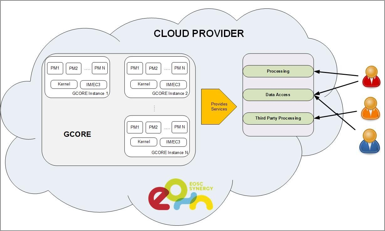
Figure represents a typical GCORE structure with a marketplace where different services are offered from third parties. The GCORE will offer different GCORE Instances types that can be deployed according to the user requests. Each user can request a specific service that implies the deployment of a GCORE Instance to perform the activities for the services. The capability of GCORE to integrate different processors and to deliver its results allows creating new services in an easy way.
In addition, all services available would benefit from the elastic and scalable up and down capacity of GCORE in order to reduce the operational costs of a third-party project.
This SW will be offered as a component to be included in complex system to implement the processing chain or as a processing framework to create hybrid infrastructures for processing activities on demand or could be published as SaaS to publish the services in the market place to be used by companies/entities or institutions focused to create added value services/products over satellite imageries.
The G-Core service targets the following three user profiles:
- EO data for the science community to use the satellite data in the scientific studies.
- EO data for public organizations to use the satellite imageries as background data.
- EO data for value adders to create added value products from satellite images.
- It will help to define new products and services mixing Earth Observation data with other types of data for scientific and social environments
The expected impact of the adaptation of the service is to democratize the usage of EO data out of the scope of nominal fields. It will help to define new products and services mixing Earth Observation data with other types of data for scientific and social environments.
Contact point for support: