WORSICA
WORSICA is a service for the detection of water using satellites, Unmanned Aerial Vehicles and in-situ data.
Water Monitoring Sentinel Cloud Platform
WORSICA is a service for the detection of water using satellites, Unmanned Aerial Vehicles and in-situ data. The main products of the service are: i) coastline detection, which includes coastal inundation areas due to storm-surge events; ii) inland water bodies detection, such as lakes, reservoirs or dams; and iii) water leaks detection on irrigation networks. This thematic service aims at integrating multiple-source remote sensing and in-situ data to determine the presence of water in coastal and inland areas. It is applicable to a range of purposes, from the determination of flooded areas (from rainfall, storms, hurricanes or tsunamis) to the detection of large water leaks in major water distribution networks. It builds on components developed in both national and European projects, integrated to provide a one-stop-shop service for remote sensing information, integrating data from both the Copernicus satellite and drone/unmanned aerial vehicles, validated by existing online in-situ data. The WORSICA service will be available without cost to all european public research groups. The private sector will be able to use the service, but some usage costs may be applied, dependending on the type of resources needed by each application/user.
The integration of the WORSICA service in the EOSC infrastructure will boost the usage of the service at an European level. This service will enable the research communities to generate maps of water presence and water delimitation lines in coastal and inland regions. These products can be useful for emergency and planning methodologies in case of inundations or reservoir leaks. In particular, the service promotes 1) the preservation of lives during an emergency, supporting emergency rescue operations of people in dangerously inundated areas, and 2) the efficient management of water resources targeting water saving in drought-prone areas.
Architecture
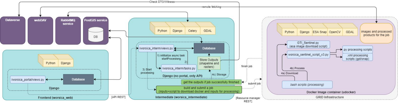
The architecture of WORSICA consists of three core components: i) a frontend component; ii) an intermediate component; and iii) a processing component. The frontend component manages all the interaction of the service with the users through a web portal, such as the configuration of the simulations and requests for the service. The intermediate component is a task orchestrator that manages all the requests that arrive from the frontend and sends them to a processing component, and also deals with input/output storage tasks, such as download/upload of the satellite images and intermediate products and metadata to be sent to the Dataverse repository. The processing component (in purple) is a container with the requirements for image processing (scripts, inputs and software) and sent to be run by a resource manager on the cloud/grid infrastructure.
EOSC Services
In the EOSC Synergy, technical aspects of the WORSICA service will be improved considerably, using advanced technologies such as high-performance computing and cloud. The service will also be scaled up to a European level to reach all interested research communities. We will also adapt the service to other European Open Science Cloud (EOSC) services, such as EGI Check-In, and include these in our workflow, such as Dataverse. Therefore, several IT services, available in the EOSC marketplace, will be implemented in WORSICA service.
- Authentication: WORSICA uses EGI Check-In for the user authentication to the Frontend (portal), and this is a requirement in order to use the available EOSC services.
- Workload Managers: Processing jobs submissions are sent by the WORSICA Intermediate service to a GRID infrastructure by using ArcCE with SLURM. This allows efficient management of the available resources for HPC in order to speed up the processing jobs.
- Data Manager: Nextcloud is used to store processed job submission data input/outputs. Dataverse is used to register processed job submission metadata information for data FAIRsFAIR compliance.
Ansible and IM tools: IM is used to deploy the infrastructure required for job processing, repositories and microservices. SLURM and Kubernetes clusters are deployed using TOSCA template over IaaS service and the remaining services will be installed from Docker images. Configurations for SLURM and Kubernetes are set up by ansible playbooks. This will be implemented in the milestone MS18 (All prototype services integrated).
Service Endpoint
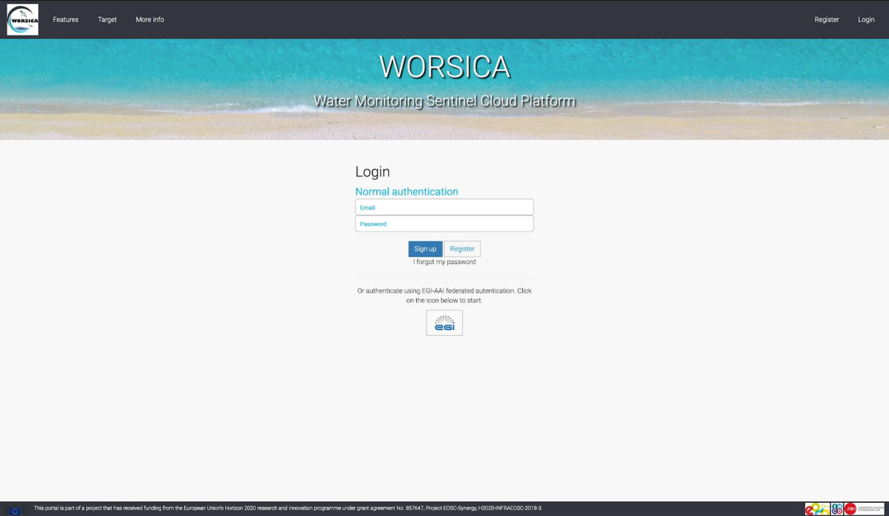
The WORSICA web interface manages all the communication with the users. The portal can be accessed using the EGI federated authentication or simply with a verified email.
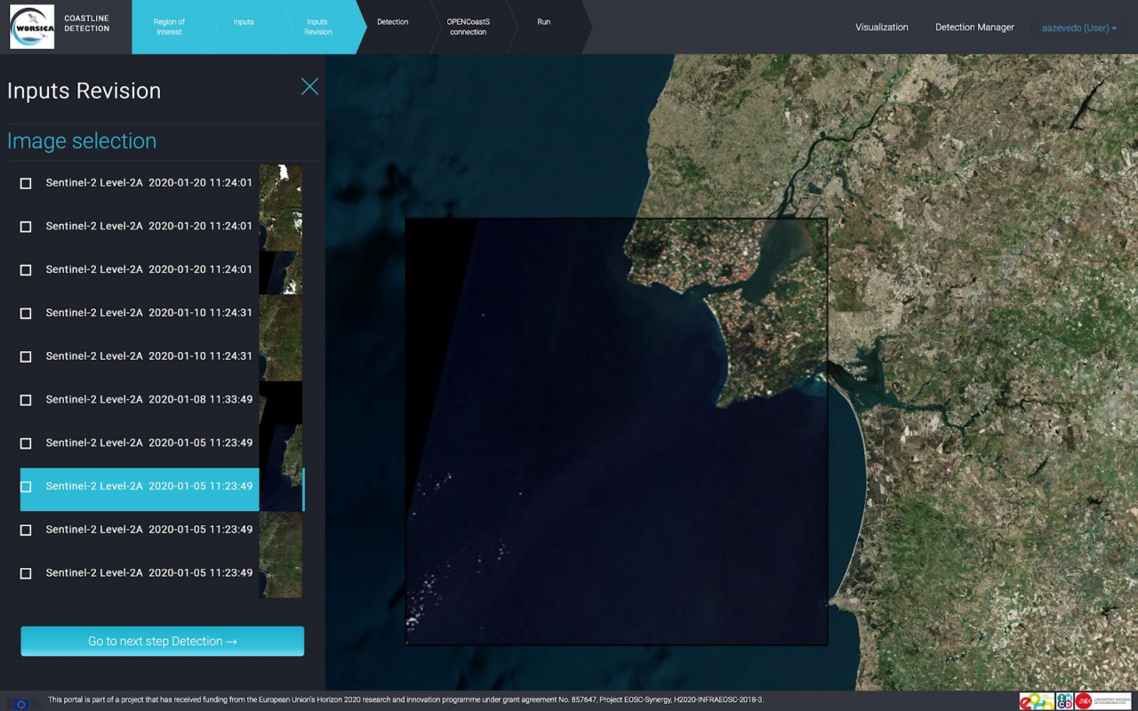
In the WORSICA’s portal the user can follow a configuration workflow. The main workflow consists in the following procedure:
I
user selects the Region of Interest (ROI).
II
the user chooses the type of images to be processed (Sentinel-2, Pleiades or Drone) and the monitoring period.
III
The user verifies which images should be processed.
IV
In the Detection menu, the user can select the water index, the number of classes for the clustering procedure.
V
afterwards, the user can specify the informations for the connection to the OPENCoastS service, in order to retrieve the tidal elevation for the same period of the images.
VI
in the last step, the user can confirm all the configuration values and submit the simulation.
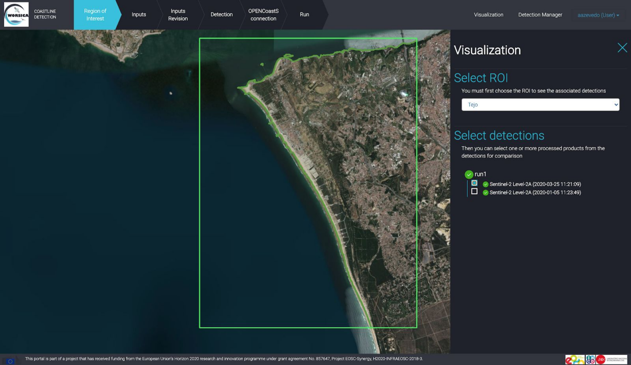
After the submission of the simulation, the user can check the results on the visualization menu.